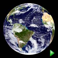
 The Blue Marble (62 mb)
Earth - The Blue Marble
Description:
The Blue Marble is an incredibly detailed, true-color depiction of the Earth. NASA is responsible for this dataset made from a compilation of satellite images throughout 2001. Most of the information came from NASA's MODIS, the Moderate Resolution Imaging Spectroradiometer, which is attached to the Terra satellite 435 miles above Earth. The background image of the land and oceans was created using data from June through September of 2001. This could not be done in a single day or even a week because on any given day clouds are blocking a significant portion of the surface. The cloud image is a composite of three days worth of data. The first two days of data were collected in the visible wavelength and the third day was needed to get a view of the clouds over the poles using thermal infrared imagery.
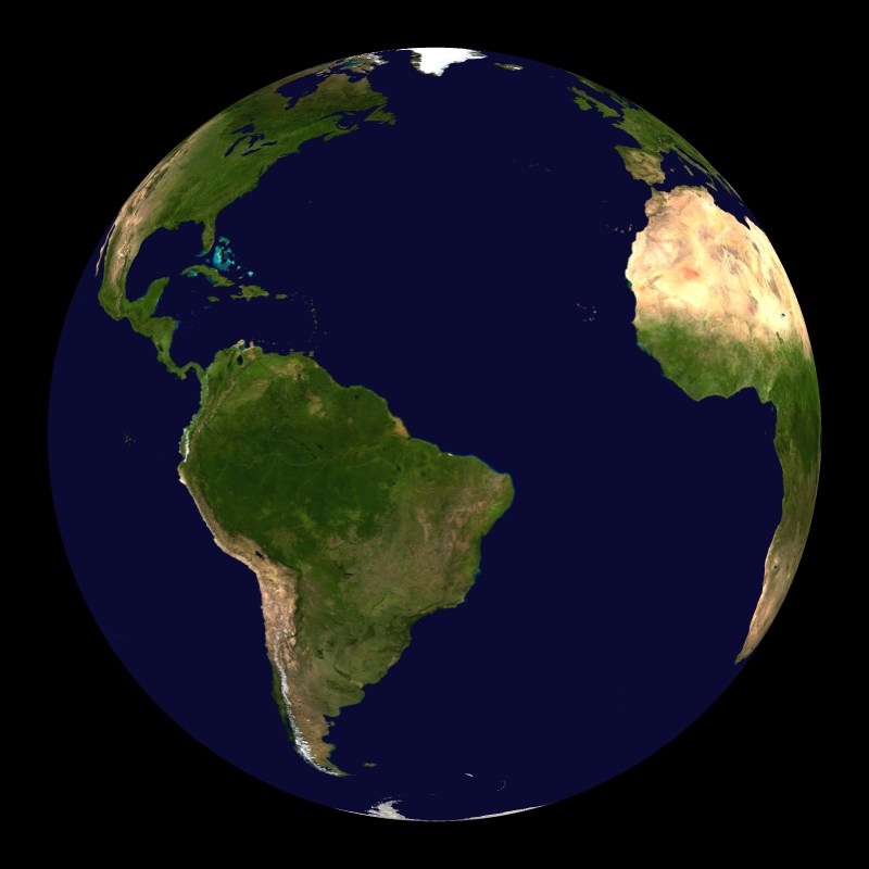 Earth with vegetation
The shading is true color with the oceans shades of blue, the clouds white and the lands varying from green to brown. The brown areas are the sands of the deserts. The shading of the land was done using a dataset compiled by the U.S. Geological Survey's Earth Resources Observation and Science Data Center.
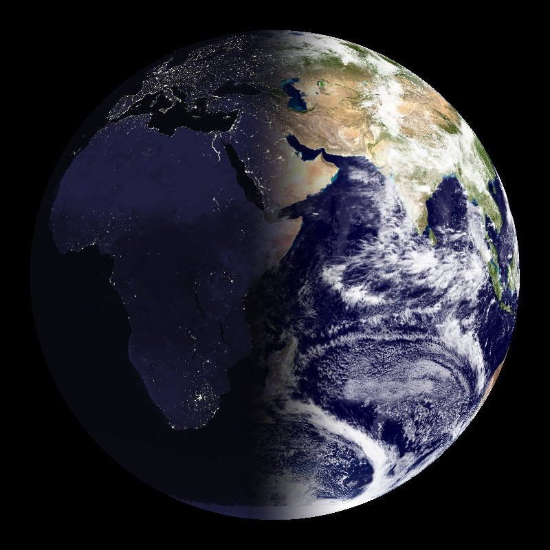 Blue Marble and Nightlights (9 mb)
Additional Blue Marble datasets are available to highlight some of the characteristics of the changing Earth. The standard Blue Marble is a year long composite to show an average view of the earth. The Blue Marble without clouds is also available in monthly composites the entire year. This monthly evolution is the seasonal blue marble. The monthly evolution allows audiences to see the changing appearance of the Earth due to the season changes. The most dramatic change is the expansion of the snow cover during the winter months and then the depletion of it during the summer months. Blue Marble: Next Generation provides an updated version of the seasonal changes dataset. The Blue Marble is also available without the cloud cover so that the vegetation can be clearly seen. This dataset has also been merged with the Nighttime Lights dataset, to create a new dataset. The new dataset shows the Earth with daytime and nighttime views of the Earth, to demonstrate how only half of the Earth is illumintated at one time.
Notable Features:
- Vastness of the Sahara Desert
- Shading done in true color: gives Earth's appearance from space
Data Category
Major:Land, Solar System
Minor: Earth
Keywords:
Land, Solar System, Earth, Blue Marble
| Data Set Name | Blue Marble (23 degree tilt) |
| Data Set Directory Name | blue_marble/blue_marble |
| Dats Set Source | NASA Goddard Space Flight Center |
| Dats Set Developer | NASA Goddard Space Flight Center |
| Visualization Developer | NASA |
| Audio | /shared/sos/media/audio/CoupeStudios/Music/BlueMarble.mp3 /data/d1/audio/wav_tracks/intro.wav |
| Download | FTP |
| Data Set Name | Seasonal Blue Marble |
| Data Set Directory Name | blue_marble/seasonal_blue_marble |
| Dats Set Source | NASA Goddard Space Flight Center |
| Dats Set Developer | NASA Goddard Space Flight Center |
| Visualization Developer | NASA |
| Audio | No |
| Download | FTP |
| Data Set Name | Earth with Vegetation |
| Data Set Directory Name | blue_marble/earth_vegetation |
| Dats Set Source | NASA Goddard Space Flight Center |
| Dats Set Developer | NASA Goddard Space Flight Center |
| Visualization Developer | NASA |
| Audio | No |
| Download | FTP |
| Data Set Name | Blue Marble and Nightlights |
| Data Set Directory Name | bluemarble_nightlights |
| Dats Set Source | NASA GSFC, DMSP |
| Dats Set Developer | NASA GSFC, NGDC Earth Observations Group |
| Visualization Developer | Steve Albers, NOAA/GSD |
| Audio | No |
| Download | FTP |